


Baviaanskloof Information - what is the Baviaanskloof?
Geographically, the Baviaanskloof is the valley running east to west between the Baviaanskloof Mountains to the north and the Kouga Mountains to the south in South Africa's Eastern Cape province. View map.
(Please note that all photographs on this web page were taken in the Baviaanskloof or in the places stated by staff of ZAWebs and are copyrighted thereto. Kindly direct any enquiries to the webmaster by e-mail)
In conservation terms, it is the Baviaanskloof Mega Reserve; a wilderness area which includes half of the valley and huge tracts of land besides. Because of its amazing bio-diversity it has been short-listed for World Heritage Site status. Read more about the Mega Reserve. (Please note - this is a LARGE .pdf document and takes a long time to download)
To others, it is simply an incredible, scenic trip of immense contrasts, ranging from the lush fertility of the Gamtoos River valley, through the rugged poorts (gaps), passes and mountains, to the stark beauty of the plains approaching Willowmore.
The virtual drive will encompass elements of all of these but can only scratch the surface of what the area has to offer. It will hopefully whet your appetite to come and visit one of South Africa’s best kept secrets.
(We have included GPS co-ordinates for the convenience of visitors who wish to print this and take it with them on their trip).
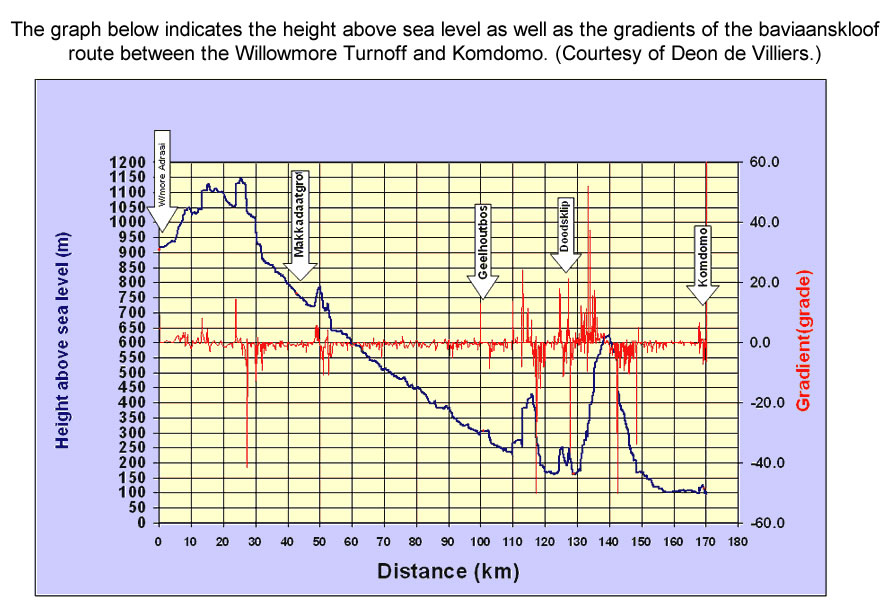
click here for a height and gradient graph
To learn more about what there is to do in the Baviaanskloof or to find places to stay in and around it, please visit www.baviaanstourism.co.za


Hankey to Patensie
 The
journey will be from east to west, originating in Port Elizabeth. From the
N2 national road take the R331 turnoff to Hankey. This is the first turn-off
after the end of the freeway.
The
journey will be from east to west, originating in Port Elizabeth. From the
N2 national road take the R331 turnoff to Hankey. This is the first turn-off
after the end of the freeway.
Shortly before reaching the town of Hankey see on the left what is claimed to be the largest sundial in the Southern Hemisphere. [S33 50.253 E24 53.156]
Turn off the road to the sundial, follow the track past it and come to the grave of Sarah Baartman, the celebrated "Hottentot Venus", who was born in the neighborhood and led a short and tragic life. (read more about Sarah Baartman).
After passing through the town of Hankey the road enters the lovely and fertile Gamtoos River valley with it's neat orchards and farms. This continues past the village of Patensie.


Patensie to the Baviaanskloof Wilderness area
 When
the road enters the cuttings past Patensie you will see exposed Enon Conglomerate
rock formation which consists of pebbles in a sandy matrix. About 140 million
years ago the Cape mountains were roughly three times higher than to-day.
A period of high rainfall then eroded them and the Enon Conglomerate was
the result. Much of the Gamtoos valley is composed of this.
When
the road enters the cuttings past Patensie you will see exposed Enon Conglomerate
rock formation which consists of pebbles in a sandy matrix. About 140 million
years ago the Cape mountains were roughly three times higher than to-day.
A period of high rainfall then eroded them and the Enon Conglomerate was
the result. Much of the Gamtoos valley is composed of this.
Along these cuttings is a rock formation known as Queen Victoria's Bust. It can only be seen from the west so you will have to stop and look back, but be careful of traffic coming round the bends. Stop at the first lay-by after going over the bridge. [S33 45.403 E24 41.278]
Shortly after the tar ends, [S33 44.710 E24 38.176] the road winds through the looming Groot River Poort with its towering sandstone cliffs.
Once through the poort you enter the rich farming area of Cambria with orchards to the right of the road and succulent thicket to the left. Cambria owes it's name to the early settlers of the district who were reminded of Wales. After leaving Cambria behind, you arrive at the Baviaanskloof proper where the road enters the Wilderness Area.


Poortjies to Bergplaas
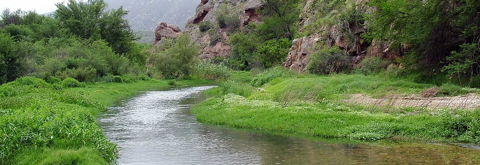
 At
first in the Wilderness Area, you are surrounded by riverine forest, with
yellowwoods, white stinkwoods and Cape figs. In fact, such patches of forest
will be found in kloofs wherever there is perennial water.
At
first in the Wilderness Area, you are surrounded by riverine forest, with
yellowwoods, white stinkwoods and Cape figs. In fact, such patches of forest
will be found in kloofs wherever there is perennial water.
From the sign "Poortjies" a short walk and wade along the stream brings you to a picturesque small waterfall and pool in the depths of the forest. After good rainfall the waterfall is even better. [S32 39.742 E25 38.803]
Have a look at Tortoise Hill on the left of the road. [S33 39.413 E24 30.610] This is an unofficial name given by the authors. Do YOU think it is apt?
Next comes the first pass of the journey, Combrinck's Pass. If you do not like steep drops, watch the mountain to the left! Stop at the sheerest part of the pass and you will see cycads growing on the opposite side of the valley below you. [S33 39.141 E24 30.325]


Bergplaas to Grasnek
 At
the top of Combrinck's Pass is Bergplaas.
At
the top of Combrinck's Pass is Bergplaas.
[Note: in case of emergency in this area, there is one small area of cellphone reception in the vicinity of S33 38.939 E24 30.219]
This and the other plateau were formed during the period of erosion and are an accumulation of the softer elements of the Table Mountain group, mainly the Goudini formation. This finer and more fertile soil supports grassy fynbos. The presence of grassland means also the presence of a wider variety of grazing animals. On Bergplaas red hartebeest and zebras are frequently to be seen.
At the far end of Bergplaas, a short walk off the road to the right will give you a good view of the old cableway which was used by the bygone farmers to transport produce and livestock across the chasm to and from the Enkeldoorn plateau, thereby saving several hours' drive. [S33 38.183 E24 27.038]
The road then descends Holgat Pass. Notice the outcrops of Bokkeveld shale which occur here. Part way down is a fine view of the cone-shaped hill Langkop. [S33 38.346 E24 27.122]
In the valley, succulent thicket predominates. This is prime country for kudu as well as the elusive Buffalo.
The road then climbs over Grasnek Pass, at the top of which is a lookout point which affords a fine vista of the ruggedness of the terrain.


Grasnek to Rooikloof
 Past
the ruins of the farm Coleskeplaas is a fine view of Scholtzberg, the highest
peak (1625m) in the Baviaanskloof Mountain range. [S33 37.180 E24 16.127]
Both this range and the Kouga range on the other side of the valley are
principally composed of hard
Peninsula sandstone, the oldest of the Table
Mountain group.
Past
the ruins of the farm Coleskeplaas is a fine view of Scholtzberg, the highest
peak (1625m) in the Baviaanskloof Mountain range. [S33 37.180 E24 16.127]
Both this range and the Kouga range on the other side of the valley are
principally composed of hard
Peninsula sandstone, the oldest of the Table
Mountain group.
In the highest parts of these ranges is to be found Alpine fynbos, a shorter variety than usually seen.
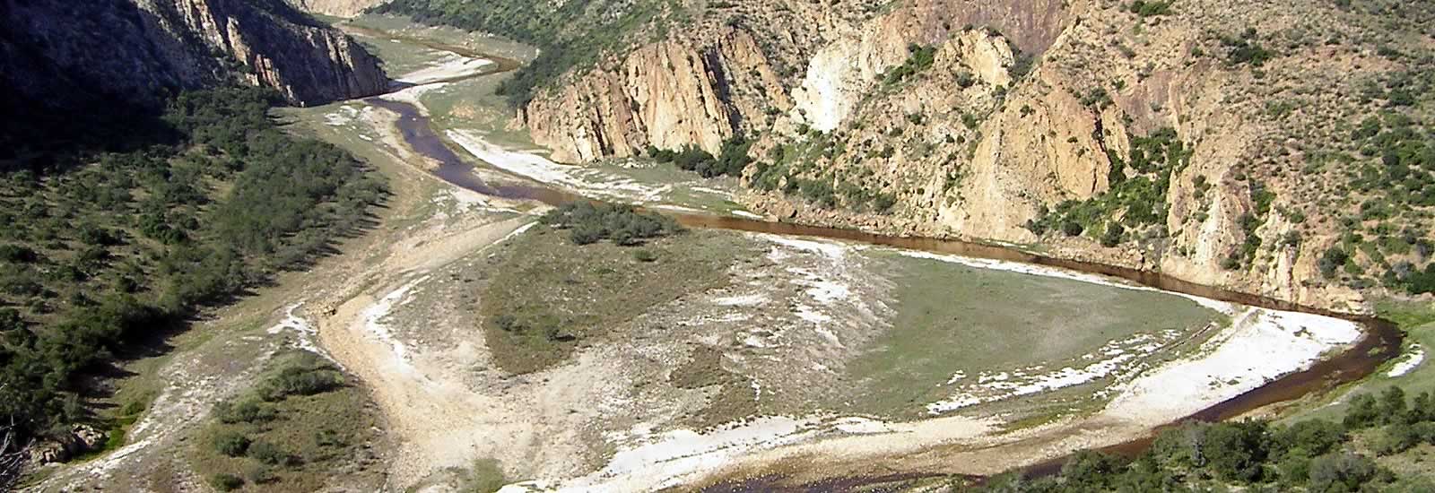
The road through the Wilderness Area ends at the aptly named Rooikloof. [S33 36.215 E24 11.981]
The Wilderness Area itself, however, continues along the Kouga and Baviaanskloof ranges to the left and right respectively.


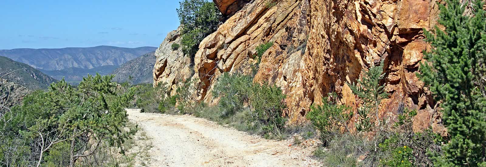
Rooikloof through Nuwekloof
 Hereafter
the road goes mainly through farmland but the mountain vistas and rock formations
on either side remain just as attractive. Along the road bottomland savanna
or valley bushveld with it's sweet thorn trees is seen but, beyond it, much
of the veld to the left of the road is either renosterveld or passerina
veld, both composed of a mixture of fynbos and succulent karoo plants.
Hereafter
the road goes mainly through farmland but the mountain vistas and rock formations
on either side remain just as attractive. Along the road bottomland savanna
or valley bushveld with it's sweet thorn trees is seen but, beyond it, much
of the veld to the left of the road is either renosterveld or passerina
veld, both composed of a mixture of fynbos and succulent karoo plants.
On the right you will see the Campbell memorial to the victims of a flood in 1916. [S33 33.058 E24 01.130]
The road then passes through Studtis Poort.
A little further on can be seen The Crocodile, a rock formation best seen from the property Speekhout. [S33 30.841 E23 46.348]
Back on the road, a very short distance further on, another interesting rock formation, The Seven Dwarves, can be seen on the right. At the same place, to the right of the dwarves is a cliff on which grow numbers of the rare Willowmore Cedar (Widdringtonia schwarzii). [S33 30.981 E23 45.944]
Nuwekloof forms the western gateway of the Baviaanskloof. In it you will see two interesting sights.
One is the Sleutel or Key, a massive rock formation which has split right through from top to bottom. It is so-called because if it ever topples over it will lock the Baviaanskloof shut from this end. It is the bulge on the left of the road. [S33 31.262 E23 39.027]
The other is the Hangleer or Hanging Ladder, the remnants of which can be seen above you. It was built by honey gatherers to gain access to the bees nests beneath the overhang of the cliff. Only a couple of rungs still exist so it can be quite difficult to spot. (If you are battling, look just below the left-hand tuft of grass on the skyline.) Since this photo was taken, however, there now (in 2006) seems to be even less of it to see than before! [S33 31.235 E23 39.037]
The road thereafter continues through the Baviaans Wes area until it strikes the N9 road from Uniondale to Graaff-Reinet, a short distance from Willowmore.


Baviaanskloof Virtual Tour - Baviaanskloof Distances & Times - Baviaanskloof Accommodation